REVIEW · AUCKLAND
Auckland: Auckland City & Hauraki Gulf Scenic Flight
Book on GetYourGuide →Operated by Waiheke Wings · Bookable on GetYourGuide
Waiheke to Auckland in one smooth hop. You’ll lift off from Waiheke Island with vineyards all around, then get the kind of views that don’t show up from the ground, including Rangitoto’s crater and the Auckland skyline arc. The pilot and local guide talk you through what you’re seeing as you go, which turns pretty sights into real places with names and context.
One catch: this flight is short at 45 minutes, and it’s also weather dependent—bad visibility can mean a reschedule. No food is included either, so plan to eat before or after.
In This Review
- Key Points at a Glance
- Why a 45-Minute Scenic Flight Works So Well Over Auckland
- Waiheke Airport: Vineyards and Coastline Before You Even Cross the Harbor
- Tracking the Hauraki Gulf: Motuhie, Browns Islands, and the Island Maze
- Auckland From Above: Sky Tower, Harbour Bridge, and North Head in One Pass
- Rangitoto’s Crater View: Why That 500-Foot Detail Is a Big Deal
- The Local Commentary: Turning Views Into Real Names
- Price and Value: Is $178 for 45 Minutes Worth It?
- Weather, Comfort, and the Small-Plane Rules You’ll Want to Know
- Getting the Best Out of Your Seats and Photos
- Should You Book This Auckland City & Hauraki Gulf Scenic Flight?
- FAQ
- How long is the Auckland City & Hauraki Gulf Scenic Flight?
- Where does the flight depart from?
- What’s included in the price?
- Is food or drinks included?
- Do I need to bring any ID?
- What are the size and weight limits?
Key Points at a Glance
- Takeoff from Waiheke’s vineyards gives you instant “wow” while you’re still climbing
- Close-up time over Rangitoto including a look into the crater from about 500 feet (152 meters) above the summit
- Auckland skyline views designed for photos, including a half-orbit around Sky Tower
- Small group size (up to 9) keeps the flight feeling personal rather than rushed
- Local commentary in English helps you spot islands and landmarks by name
- Weather matters in this region, so flexibility is a real part of the experience
Why a 45-Minute Scenic Flight Works So Well Over Auckland
Auckland is spread out. Driving to viewpoints takes time, and daylight can slip away faster than you think. This is the clean solution: 45 minutes in the air gives you city highlights and Gulf islands without the “where do we park?” stress.
I like that the flight is built around two very different worlds. You start in the island culture of Waiheke, then shift to Auckland’s urban landmarks. That change of scenery is the whole payoff, and it happens quickly.
If you’re the type who enjoys geography—coastlines, volcanic features, island patterns—this flight turns the map into something you can actually see. You’re not just looking down; you’re learning what those shapes are and why they matter.
You can also read our reviews of more city tours in Auckland


Waiheke Airport: Vineyards and Coastline Before You Even Cross the Harbor
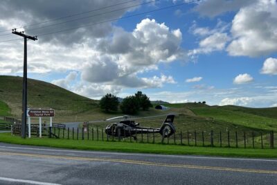
Your trip kicks off at Waiheke Airport, and the early minutes set the tone. The area is surrounded by vineyards, so you get a mix of textures right away: neat rows of vines, then the coastline cutting into the island.
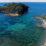
Once you lift off, you’re treated to Waiheke’s coastline views—beaches, coves, and that unmistakable Gulf coastline feel. There’s a real advantage here: you’re starting from the island itself. Instead of flying over the “idea” of Waiheke, you’re seeing it as a patchwork of shoreline and farmland.
The flight follows the coastline for a while. That matters, because you get to visually connect what you might hear about Waiheke—its beaches, bays, and wine country—into one continuous picture rather than random glimpses.
And yes, the small details can be fun: in good conditions you may even catch bright weather effects over the water. One passenger mentioned a beautiful rainbow during the flight—when light hits the Gulf just right, the sky can add its own show.
Tracking the Hauraki Gulf: Motuhie, Browns Islands, and the Island Maze
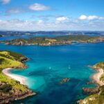
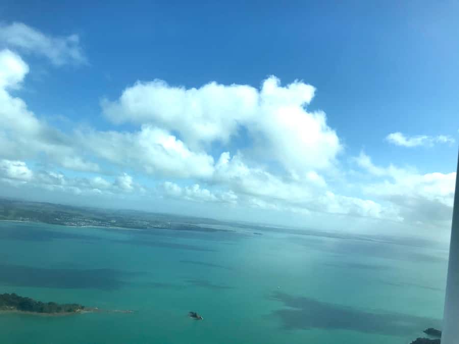
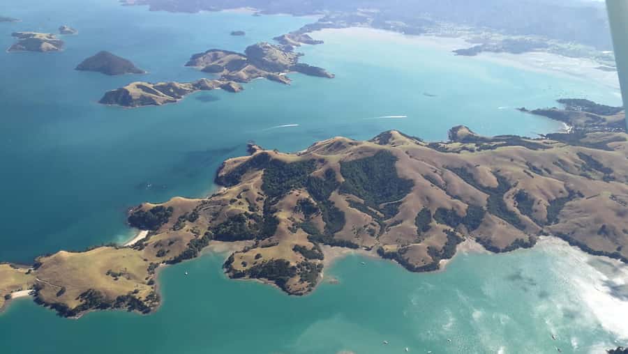
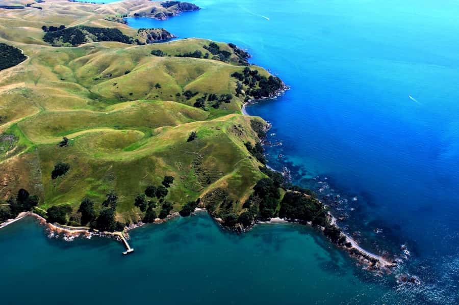
As the route progresses, you’ll pass by Motuhie and Browns Islands. This is the part that makes the Hauraki Gulf feel like more than scenery. From above, the islands look like they’re scattered with purpose—small landmasses sitting in a big body of water, each with its own coastline shape.
The Hauraki Gulf is famous for its islands and the way the water wraps around them. From ground level, you can miss that pattern because you’re too focused on one beach, one walk, or one road. From the air, the whole system makes sense fast.
Then comes the moment the route turns toward Auckland: you follow the coastline first, then break off to track in the direction of the city. That transition is one of the reasons this flight is worth it even if you’re short on time. You go from “island mode” to “city mode” smoothly, and you feel the change instead of watching two separate tours happen on separate days.
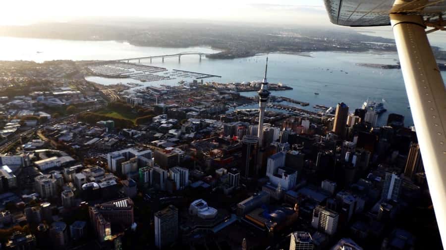
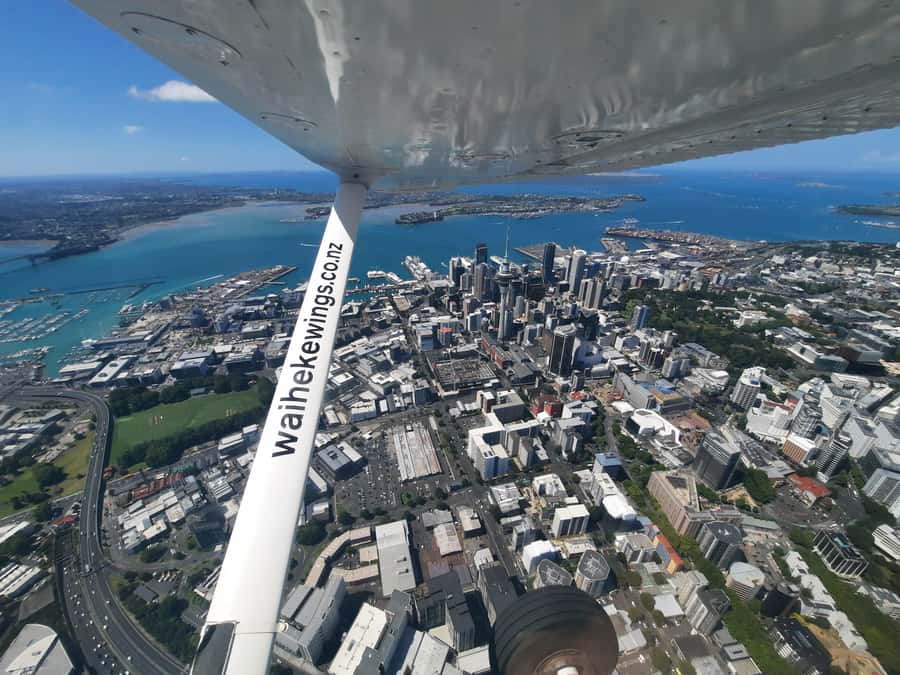
Auckland From Above: Sky Tower, Harbour Bridge, and North Head in One Pass
Once you’re heading toward Auckland, the skyline starts to appear like it’s being drawn in real time. You’ll see the city from the air with a clear view of key landmarks, and the flight is planned for viewing, not just getting from point A to point B.
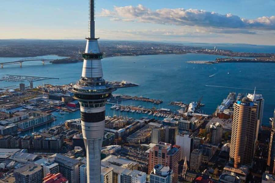
One of the best photo moments is the half-orbit of Sky Tower. That’s a smart move: instead of a single pass where the tower flashes by, you get a sustained angle that’s easier for pictures. You also get a feel for how Sky Tower anchors the urban core in relation to the harbor area.
After that, you’ll cruise past several big identifiers: the Harbour Bridge, Davenport Naval Base, and North Head Volcano. Seeing those in sequence gives you context. Bridges, military sites, and headlands can feel abstract from a distance. From the air, they line up visually, and suddenly the geography you’ve heard about has shape.
Even if you’re not the type who makes a lot of photos, this skyline segment is still valuable. It helps you understand how Auckland sits on the water and why so much of daily life is oriented toward the harbor.
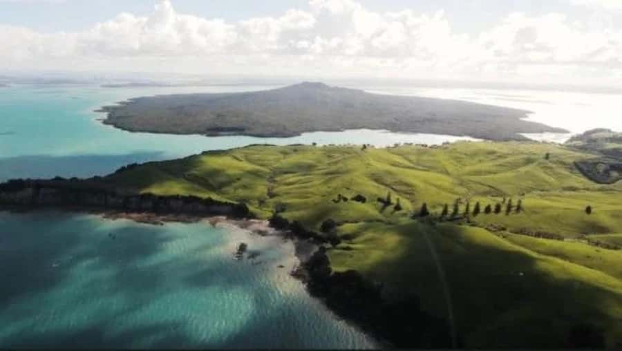
Rangitoto’s Crater View: Why That 500-Foot Detail Is a Big Deal
If Auckland is the reason for the city views, Rangitoto is the reason this flight feels memorable.
You’ll marvel at New Zealand’s youngest volcano, and then you’ll get the chance to peer into the crater while flying just about 500 feet (152 meters) above the summit. That altitude detail matters. You’re not looking at Rangitoto the way you’d see it from a boat or a distant viewpoint. You’re seeing enough to understand the crater as a feature, not just a dot on the map.
Volcanoes can be hard to picture until you see how the crater shape sits above the surrounding terrain. This is the part where a scenic flight turns into a mini science lesson—without feeling like homework. With the guide’s commentary, the visual cues (shape, elevation, location) click into place fast.
This stop is also a good reminder of why the Auckland region is unique. In many cities, the landforms are ancient or subtle. Here, volcanic history sits right there in the scene, and you get to look at it directly.


The Local Commentary: Turning Views Into Real Names
A scenic flight is more than looking down. What makes this one better is the commentary from a local guide (in English), plus English audio included. That pairing helps in two ways: you catch the essential info live, and you can absorb it again if you want.
For me, the win is that landmarks are explained as you pass them. When you can connect a feature like Rangitoto or a harbor landmark to a name and a quick bit of context, the views feel purposeful instead of random.
And it’s not just about facts. Good guiding changes how you look. When you know where Motuhie and Browns Islands sit, you can spot the patterns faster. When you know what you’re flying over at North Head, the coastline suddenly reads like a story with chapters.
Price and Value: Is $178 for 45 Minutes Worth It?
At $178 per person for about 45 minutes, the math depends on what you’re comparing it to. If you’re comparing it to spending a full day chasing viewpoints by car, the value is strong. You’re paying for time efficiency plus coverage: Waiheke, key Auckland landmarks, and Rangitoto in one shot.
If you’re comparing it to a longer flight experience, it’s shorter by design. That’s the trade. You won’t get hours of wandering over every island in the Gulf. Instead, you get a focused route that hits the big emotional targets fast: coastline-to-city transition, Sky Tower photo time, and a crater close-up.
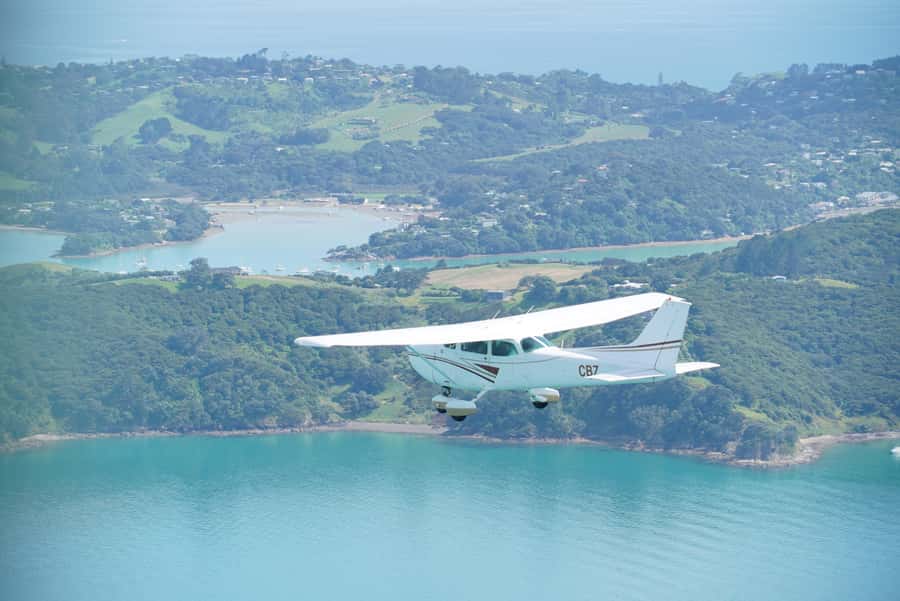
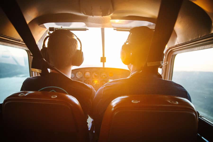
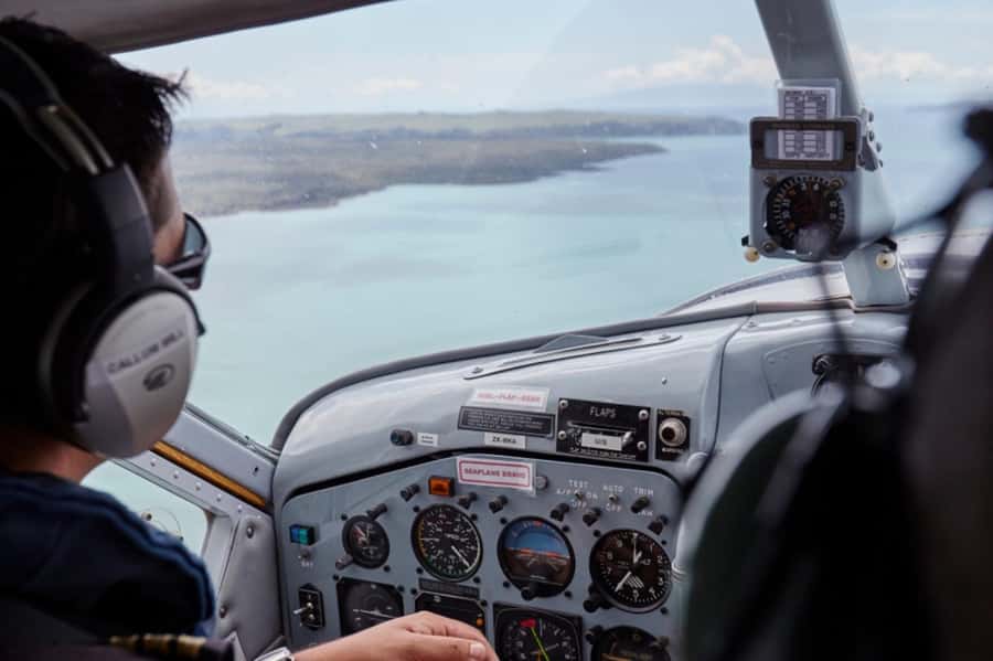
You’re also paying for the format: a small group limited to 9 participants. In practice, that often means less waiting and a smoother ride in a smaller aircraft. One passenger specifically noted the flight felt smooth even in a small plane, and that lines up with why these short flights work well.
Also consider what’s not included. No food and drinks are part of this. That’s not a dealbreaker, but it means you should plan a meal around it so you’re not hungry during boarding and check-in.
Weather, Comfort, and the Small-Plane Rules You’ll Want to Know
This is the big practical point: weather plays a significant part in whether the flight operates. If conditions don’t allow a safe and enjoyable experience, the activity can be canceled and rolled to the next available flying day. So your best strategy is to book a day that gives you flexibility in Auckland/Waiheke.
Comfort-wise, think layers. You’ll want weather-appropriate clothing, because the plane temperature will be similar to outside. And bring comfortable shoes, mainly for getting around the check-in area and walking through whatever ground setup is needed.
Now for the rules that affect packing. You can’t bring luggage or large bags, and selfie sticks aren’t allowed. If you travel light anyway, you’ll be fine. If you’re used to packing like you’re moving apartments, this is a good moment to trim down.
One more important detail: you’ll need to provide individual weights when booking. The flight isn’t suitable for anyone over 110 kilograms (243 pounds), and if you’re above that threshold, you’re asked to contact the local partner after booking.
None of that is meant to be fussy. In a small plane, weight and space really do matter. If you follow the rules, boarding tends to go smoothly.
Getting the Best Out of Your Seats and Photos
I can’t promise where you’ll sit, because the exact details aren’t provided here. But you can still improve your odds for great views.
If photos matter to you, remember the flight includes a half-orbit of Sky Tower. That’s the moment to be ready—camera up, settings where you want them, and you’re ready to shoot as the skyline rotates.
For the volcano, the crater view near the top is the standout. Since you’re flying around the summit area at roughly 500 feet above the crater, treat it like the “main event” of the route. That’s also the time when you’ll likely want to look with your own eyes first, then photograph right after.
And even if you don’t take photos, keep your gaze moving. The route is designed for sequence: coastline, islands, then city landmarks, then volcanic terrain, then back. When you track the sequence, you feel the geography more clearly.
Should You Book This Auckland City & Hauraki Gulf Scenic Flight?
Book it if you want maximum variety in minimum time. This works especially well if you only have a short window in Auckland or you’re already spending time around Waiheke. It’s also a smart choice when you’d rather see the Gulf and the skyline without adding hours of road travel.
Skip it—or at least plan with flexibility—if weather is likely to be rough on your dates. Since the flight depends on conditions, your schedule needs a little give. Also skip it if you’re expecting a full-day experience or food included. This is a focused aerial route, not a picnic with views.
If you’re trying to decide between spending a day on the ground versus a short flight that connects everything visually, I’d lean toward booking. You get Waiheke, Auckland’s core landmarks, and a real crater view in under an hour. That kind of coverage is hard to match any other way.
FAQ
How long is the Auckland City & Hauraki Gulf Scenic Flight?
It runs for 45 minutes.
Where does the flight depart from?
The flight departs from Waiheke Airport. There are also starting location options listed as North Shore Airport depending on the option booked.
What’s included in the price?
You get the 45-minute scenic flight plus commentary from a local guide (English). An English audio guide is also included.
Is food or drinks included?
No. Food and drinks are not included.
Do I need to bring any ID?
Yes. You should bring a passport or ID card.
What are the size and weight limits?
The activity isn’t suitable for people over 110 kilograms (242 pounds). You also need to provide each traveler’s individual weight when booking, and the info is used for safety/eligibility.